Precision for a Safer Future: The Benefits of Airports Adopting LiDAR Solutions
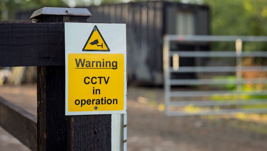
Airports are among the most complex and high-risk environments in modern infrastructure. With thousands of passengers, multiple access points and critical assets spread across vast areas, ensuring security is a monumental challenge.
Between 2024 and 2025, there were 13 airport perimeter control incidents at global airports, according to the International Air Transport Association (IATA). These incidents highlight the urgent need for advanced perimeter protection solutions.
Traditional perimeter protection methods such as video, radar, and fence-based sensors have long struggled with false alarms and limited accuracy. LiDAR technology is emerging as a solution, offering precision, adaptability and integration capabilities previously unavailable in airport security.
LiDAR (Light Detection and Ranging) uses laser pulses to create highly accurate three-dimensional (3D) representations of environments. Unlike cameras or radar, LiDAR provides full 3D coverage with millimeter-level precision, enabling airports to monitor spaces in real time with unparalleled accuracy. It also addresses privacy concerns because it does not capture identifiable images.
From Perimeter Protection to Asset Security
Traditional perimeter systems often fail under real-world conditions, triggering false alarms due to poor quality video images. LiDAR excels by creating virtual detection zones along fence lines, including pre-alarm areas that allow monitoring without triggering unnecessary alerts.
In urban airports, where perimeters often border parking lots and public roads, LiDAR can detail histories of movement, enabling forensic analysis if an incident occurs. Beyond perimeters, LiDAR protects high-value assets such as fuel farms, cargo zones, and executive hangars in concert with digital twins—precise 3D models of critical zones.
LiDAR’s versatility extends to detecting contraband transfers across secure boundaries, where items could be tossed over fences or walls. Its ability to detect small objects in motion adds a layer of protection that traditional systems often miss. In emergencies—such as fires or active shooter incidents—LiDAR can create geofenced safe zones, count individuals within them, and ensure everyone is accounted for.
LiDAR Uses for Ground Support
While LiDAR has proven effective for airport perimeter and asset security, its potential also extends into ground support operations, where precision and safety are equally critical.
During major events, airports often manage hundreds of private jets on limited tarmac space. A digital twin of the tarmac, combined with LiDAR sensors mounted on light poles, can create a live 3D map of all aircraft positions. If a plane moves too close to another, the system can issue an immediate alert, preventing costly collisions and enhancing safety.
LiDAR sensors integrated with digital twins can also monitor the movement of fuel trucks, catering vehicles, and baggage carts. By tracking velocity and lane adherence, the system can automatically flag speeding or unauthorized entry into restricted zones. This reduces congestion and minimizes the risk of accidents on the ramp.
Beyond collision prevention, LiDAR can identify anomalies such as a bag falling off a cart or wildlife entering the runway. The system can automatically point cameras to the location and notify staff for immediate action.
Digital twins combined with LiDAR also allow airports to simulate ground operations in advance. This predictive capability helps optimize layouts for peak traffic periods, reducing bottlenecks and improving turnaround times.
LiDAR as Part of a Security Ecosystem
U.S. airports handled more than 900 million passengers in 2024, according to the latest numbers available from the Transportation Security Administration. This operational scale demands technologies that integrate seamlessly with existing systems to maintain efficiency and security.
LiDAR is most effective when integrated into an airport’s broader security ecosystem. Through open application programming interfaces, LiDAR systems can feed alarms and video streams into existing video management systems and access control platforms.
As airports evolve into smart, connected ecosystems, LiDAR will play a pivotal role in delivering both security and operational intelligence. By reducing false alarms, protecting critical assets, and enabling advanced forensic capabilities, LiDAR is not just a tool for today’s airports; it is a cornerstone of the next generation of aviation security.
Nick Karakulko is senior director of critical infrastructure projects and transportation for Hexagon’s Safety, Infrastructure & Geospatial Division, a planned part of Octave, the proposed software spin-off from Hexagon AB.
© Nick Karakulko