Mapping the Blaze: How the U.S. Forest Service Uses Drones for Fire Management
Flying low and slow in a helicopter over the Sam Houston National Forest in Texas on 17 March 2019, Tahoe Helitack Captain Daniel Laird was working with the U.S. Forest Service to support a controlled fire operation when the worst-case scenario happened. The helicopter’s engine lost complete power and descended onto the forest floor on its side—injuring the crew and killing Laird.
A subsequent investigation by the U.S. National Transportation Safety Board (NTSB) revealed that a loose fuel-line was not secured with safety wire, as required, and it disconnected, causing the engine failure that led to the crash.
“Daniel started as a seasonal firefighter on the Tahoe [National Forest] and worked his way up to Helitack Captain,” according to a letter from the U.S. Forest Service Regional Forester Randy Moore about the incident. “His passion was in aviation, but he was also known for his ability to lead a strike team of engines or a task force of hand crews and heavy equipment. He was a true leader in every sense.”
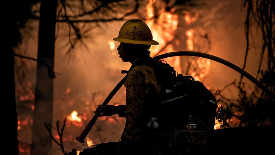
As part of forest and land management practices, U.S. government agencies have conducted controlled—or prescribed—burns, setting planned portions of the landscape on fire to thin undergrowth that could fuel wildfires and promote new forest growth. This work is important, but it’s also dangerous.
In 2021, the most recent year that data is available for, 70 firefighters died in the line of duty; two of those deaths occurred when an aircraft crashed on a wildland fire, according to an annual study by the National Fire Protection Association (NFPA).
To lessen the risks for humans that comes with fire management is one reason that the U.S. Forest Service has been working during the past five years to create an uncrewed aircraft system (UAS) to carry out its mission, says Dirk Giles, national uncrewed aircraft systems program manager for the Forest Service.
“The real benefit of these types of systems is to reduce the exposure, to normalize hazardous risk that employees face on a daily basis,” he adds.
Building the Program
While U.S. federal forest management programs have existed since 1876, the Forest Service as it is known today was created in 1905. It employs approximately 30,000 people managing 193 million acres as part of its mission within the U.S. Department of Agriculture to sustain the health, diversity, and productivity of the nation’s forests and grasslands to meet the needs of present and future generations.
A key aspect of this caretaking mission is monitoring the conditions of the land to understand how it changes over time, the effects of floods and droughts, and what impacts man-made efforts—like roads and campgrounds—will have. In the past, humans may have been sent out into the field to do this work and document their findings in handwritten logs accompanied by photographs.
Today, much of it is being done by the service’s UAS fleet, which Giles was recruited to oversee. Giles has more than 26 years of experience in aviation and wildfire management. Most of this comes from managing the military zone for the Alaska Fire Service to contain prescribed fires used for training.
“We were looking at some alternative ways to perform the mission—and safer ways—which led towards an unmanned system within that portfolio,” Giles says.
The U.S. Department of Interior had been dabbling with UAS technology since the early 2000s, mainly in partnerships with the U.S. Customs and Border Patrol, the National Guard Bureau, and the National Aviation and Space Administration (NASA). With some changes in the U.S. Federal Aviation Administration (FAA) rules, an executive order from the Trump administration, and a legal mandate from the Dingell Act, however, the department began looking to create its own UAS project. In 2018, Giles joined the Forest Service to lead the effort.
He started with a risk assessment to understand what the program needed to look like now and into the future. The program would need to encompass missions for natural resources, wildland fires, emergency support for search and rescue, and law enforcement investigations. It would also need a national office influencing base standards, policy, and training for the program, which was then managed at the regional level and implemented locally, Giles says.
The program would consist of an executive steering committee and advisory group, a national program manager, a national UAS fleet manager, and specialists and pilots. Giles explains they also developed a training curriculum for pilots and a system to procure the UAS themselves.
SponsoredHoneywell Drone MitigationCollecting real time data on drones in your airspace helps evaluate potential threats going forward so you can better protect your facility and critical assets. |
Forest Service UAS pilots must possess a valid FAA Remote Pilot license and a valid Interagency Remote Pilot card with an endorsement for the UAS to be flown. Pilots must also undergo regular refresher training, such as flying aircraft that they are credentialed for at least once every 12 months.
“Last year we trained around 192 people. This year, we’re on track to train about 200, and that’s a mix of fire and resource management,” Giles added. “It’s a rapid expansion and growth.”
As far as the technology itself, the Forest Service began testing and evaluating UAS in 2019. That work was delayed a bit when the COVID-19 pandemic began in 2020, but the service still established its initial contracts and has acquired approximately 230 UAS, with many more likely to be purchased in the future.
A major focus for the Forest Service program has been purchasing UAS components from U.S. manufacturers. All of its existing UAS acquisition contracts are with U.S. vendors. This also helps with routine maintenance and repairs, since some repairs can be made by the Forest Service team while others need to be sent back to the manufacturer to address.
“That’s part of our relationship with our domestic manufacturers—the maintenance to keep it going—and then we have clauses on our contracts for research and development, so if we want to see something different, we can now work with the manufacturer to implement those changes on our behalf,” Giles says. “It benefits me, and it’s also benefiting the industry because if we want it, I guarantee other people want it as well, too.”
Additionally, the Forest Service created a software program to help track all of its UAS componentry and the amount of flight time for pilots.
“Then if there are any maintenance deficiencies, we can track that in the software in real-time now,” Giles adds. “It’s an exciting time to be part of not just this program, but aviation in general. There is so much evolution, and you’ve got to remain ahead of it.”
In the Field
While the Forest Service uses UAS for various types of missions, the overarching goal is to use the technology to improve employee safety.
For the service’s prescribed fire missions, for instance, human pilots used to go out on aerial ignition missions in helicopters, flying at low altitude and slow speeds to set a fire line for a prescribed burn.
“If there’s any type of mechanical issue with that mission or the helicopter itself, the outcomes could be catastrophic. We’ve crashed a handful of helicopters with a handful of agency employee and contractor fatalities,” Giles says. “So, we were looking at that mission of low and slow helicopter profiles in aerial ignitions, and how we can remove the helicopter and put an unmanned system within that risk portfolio.”
Now, the service uses UAS for prescribed burn missions, including assessments of the land pre-burn, monitoring the effects during the burn, and assessing the fire effects and conditions post-burn to ensure it met the desired outcome.
“We’re very focused on where we can fly, where we can take off from, what is the burn pattern that the unit or burn managers are looking for, and we really work closely with those folks,” Giles says.
This contrasts with a wildland fire—commonly known as a wildfire—where the service is reacting to a natural phenomenon. In these instances, the Forest Service works with partners to establish a fire line to try to calm or cool the fire to avoid causing extreme devastation. This can be done by humans on the ground or in a helicopter, but the service is also using UAS to perform this work.
“We can now have this UAS system performing this mission a little bit deeper where it’s a little bit safer for the ground troops,” Giles says.
In simple terms, the service can use the UAS to deliberately set vegetation on fire to rob the wildfire of additional fuel that it might use to grow. This tactic is one of three suppression methods often used by firefighters in the field to extinguish a wildfire or manage its path.
This method relies on a UAS that is about three feet tall with rotor blades that are 36 inches long, making the vehicle about four feet wide and weighing hundreds of pounds. It also contains a Plastic Sphered Dispenser (PSP), full of spheres that the Forest Service has nicknamed dragon eggs. The eggs are between the size of a paintball and ping-pong ball and contain potassium permanganate. Approximately 450 eggs can be loaded into a UAS, which will then inject with them with antifreeze as it ejects them out of the UAS while flying over a forest.
“Then it just ping-pongs down through the canopy to the surface floor,” Giles says. “Then, about 20 to 30 seconds later, you get a little tiny ignition. It’s essentially a way to very strategically put a piece of fire onto the landscape.”
Software for the UAS also allows the Forest Service to program it to fly a certain path and drop the spheres at a specific rate—such as one every 50 feet.
The Forest Service used this method in 2022 when it responded to a wildland fire in California. There was a specialized UAS—an aerial ignition module—on the scene as the fire was getting ready to crest a ridge line. The response team flew the UAS and used it to create a fire line, guiding the fire down the slope, which was a critical watershed for several communities in the area.
“They did that all night long and brought the fire right to the edge of town where the ground troops could extinguish the fire very safely,” Giles adds. “Typically, that operation, they would’ve just burned out around the town and the fire would’ve just run up the hill and pretty much killed everything in its path.”
Post-burn analysis found that by using the UAS ignition method, the response team cooled the fire enough that it only caused an understory burn—a lower intensity burn that didn’t destroy the watershed. Use cases like this one demonstrate the potential that UAS has for fire management.
“If we have the time to be there to do something proactive and get ahead of the fire, there are incredible outcomes and far-reaching ramifications,” Giles explains. “We don’t have to worry about that completely burned-out hillside that is going to be an impact for years to come.”
To conduct missions like this requires sophisticated technology, but it also requires trained personnel who can use it to its full potential. Pilots who conduct missions for wildland fires, for instance, must also attend an incident response class conducted by the National Wildfire Coordinating Group. They also must complete a mentorship process, followed by an evaluation, to obtain certification before piloting a UAS for these missions.
“We want to make sure that the student is up to the challenge and can perform these missions safely,” Giles says. “It’s all on-the-job training with mentors, inspectors, and evaluators. It’s not like we’re just throwing anybody at these missions. It’s very calculated because we’re mixed with a lot of different aviation assets, so we have to respect that airspace within a wildland fire.”
Future Goals
Looking forward, one of the big goals for the Forest Service is to develop a larger payload capability for wildland fire management uses. Right now, its UAS program using the dragon eggs can treat 300 to 500 acres.
“The flight times with battery chemistry are pretty limited, especially when you’re carrying a heavier payload,” Giles says. “We can fly for maybe 30 minutes with our existing payloads.”
Research and design teams have developed a system that could carry a payload of 4,000—far more than the current maximum of 450 spheres—which would dramatically increase the Forest Service’s UAS capability for fire management.
Additionally, the Forest Service is partnering with NASA on a project called Stereo—a scalable traffic management for emergency response operations systems. UAS, unlike other aircraft in the sky, do not participate in “see and avoid”—the practice of a pilot in one aircraft seeing another aircraft in the sky and taking measures to avoid it. This is because a UAS does not have a digital signature, so other pilots likely can’t see it in enough time to react.
“The NASA technologies now enable our operators to see them, and we can avoid them either by altitude or horizontally without them knowing,” Giles explains. “We can communicate our position and our location, but they can’t see our system in real-time.”
Through its work with NASA, the Forest Service is looking at how it can push telemetry data on UAS position and location to pilots in real time.
“It’s looking at all this next-gen technology that’s coming for the Uber’s of the sky or whatever,” Giles says. “Somehow, some way, they’re going to have announce their position, location, and their intent. It just doesn’t really exist right now.”
The Forest Service will also continue to use its UAS program in new ways to enhance the safety of humans, an aspect of the job that Giles says he’s passionate about—especially after conducting an aerial ignition mission in the Sam Houston National Forest in 2022, three years after Laird’s death.
“We all knew him. He was a great person,” Giles explains. “Now, I’m doing [that mission] with an unmanned system. To show that local forest and the regional leadership that change is coming and it’s happening in real-time. To me, that was something we could really stand behind and say, ‘This is extraordinary. We’re not just out here doing it to do it; we’re doing it to impact the safety of our troops on the ground.”
Megan Gates is senior editor at Security Management. Connect with her at [email protected] or on LinkedIn. Follow her on Twitter: @mgngates.
