U.S. National Weather Service Predicts Heavy Hurricane Season
If forecasters at the U.S. National Oceanic and Atmospheric Administration (NOAA) are correct, 2022’s Atlantic hurricane season will be the seventh consecutive above-average hurricane season.
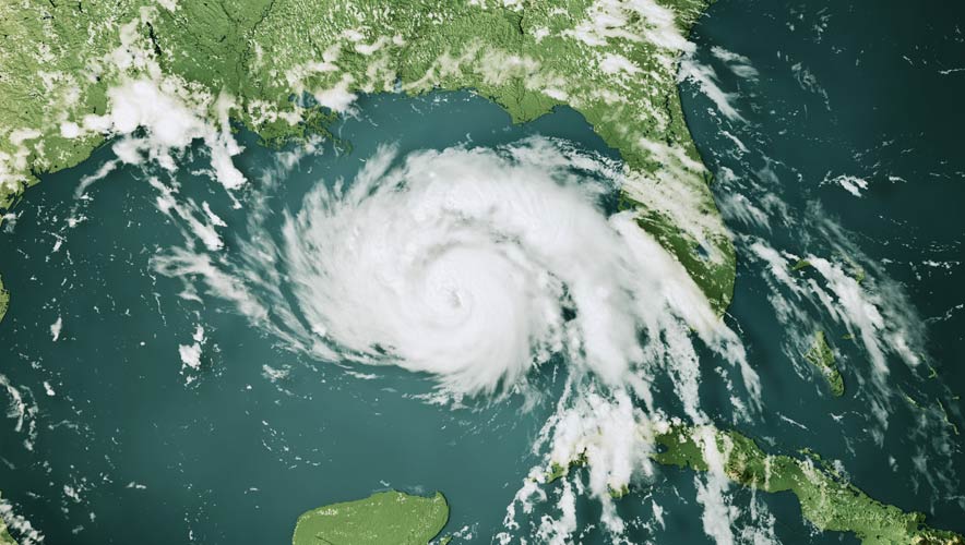
The 2022 Atlantic hurricane season extends from 1 June through 30 November, and forecasters predict a 65 percent change of an above-average season. The season is likely to have a range of 14 to 21 named storms—meaning they have wind speeds of 39 miles per hour or higher—of which six to 10 could become hurricanes with wind speeds of 74 mph or higher. This tally could include up to six major hurricanes—category 3, 4, or 5, with winds of 111 mph or higher. NOAA notes the ranges are provided with a 70 percent confidence.
Hurricane damage has picked up year over year recently, and 2021’s Hurricane Ida, which swept along the East Coast of the United States from New Orleans to New York, is estimated to have caused $95 billion in damage, according to AccuWeather. Beyond the damage to houses and cars, the estimate includes variables like the impact of people being unable to get to work, travel disruption, tourism disruptions, and the cost of cleaning up the debris, CNBC reported.
The 2020 hurricane season broke records across the board, and it had 30 named storms.
This year’s increased activity is attributable to multiple climate factors, NOAA said, including an ongoing La Niña weather pattern, warmer-than-average sea surface temperatures in the Atlantic Ocean and Caribbean Sea, weaker tropical trade winds, and an enhanced west African monsoon. In addition, the Gulf Loop Current—a “600-foot-deep river of hot Caribbean water that travels between Cancun, Mexico, and western Cuba into the Gulf,” said CNN meteorologist Chad Myers—is flowing further north, forcing warm water closer to the coast, which can intensify any storms in those areas. The loop will likely be in a similar position this year to where it was in the record-breaking 2005 season, when Hurricanes Katrina and Rita made landfall.
Atlantic #HurricaneSeason Outlook 2022: 70% likelihood of 14-21 named storms of which 6-10 could become hurricanes, including 3-6 major hurricanes: https://t.co/a9MLVIUI3I #HurricaneOutlook pic.twitter.com/UpH2uxmjpx
— NOAA (@NOAA) May 24, 2022
A single storm can have a long-lasting impact on a region, but a series of them can be devastating.
“As we reflect on another potentially busy hurricane season, past storms—such as Superstorm Sandy, which devastated the New York metro area 10 years ago—remind us that the impact of one storm can be felt for years," According to a statement from NOAA administrator Rick Spinrad. "Since Sandy, NOAA’s forecasting accuracy has continued to improve, allowing us to better predict the impacts of major hurricanes to lives and livelihoods.”
NOAA is boosting its products and services this season, including operating five uncrewed surface vehicles to measure ocean and atmospheric conditions; transitioning forecast models to a supercomputing system for uninterrupted operational forecasts; extending the lead time for the Excessive Rainfall Outlook from three days to five to give more notice about flash flooding risks from storms; and enhancing an experimental graphic that depicts the peak storm surge forecast.
While the Atlantic hurricane forecast is high, NOAA predicts a 60 percent chance of a below-normal tropical cyclone season in the Central Pacific, with two to four tropical cyclones expected. The Central Pacific Hurricane Center only cites a 10 percent chance of an above-average season.